
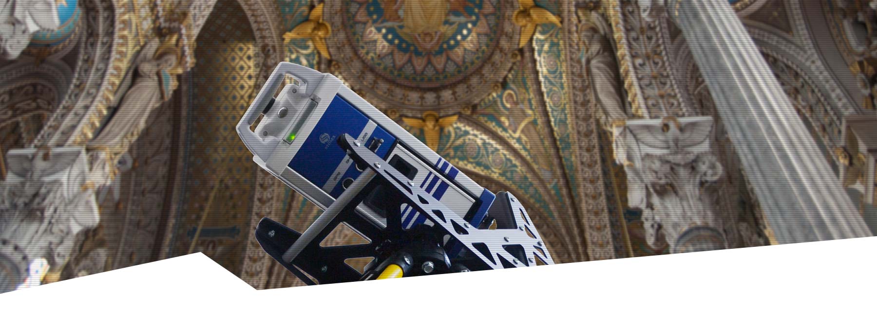
Stonex X200GO
The Stonex X200GO SLAM Laser Scanner has been developed for professionals like you who want to combine speed and detail in one user-friendly solution. With advanced SLAM technology and integrated RTK functionality, you can effortlessly capture even the most complex environments without the hassle of multiple scan positions or time-consuming post-processing.


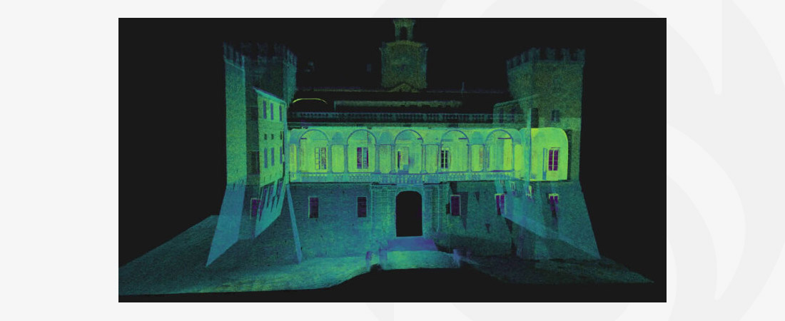
Stonex X200GO SLAM Laser Scanner
Mobile measurements with unprecedented precision
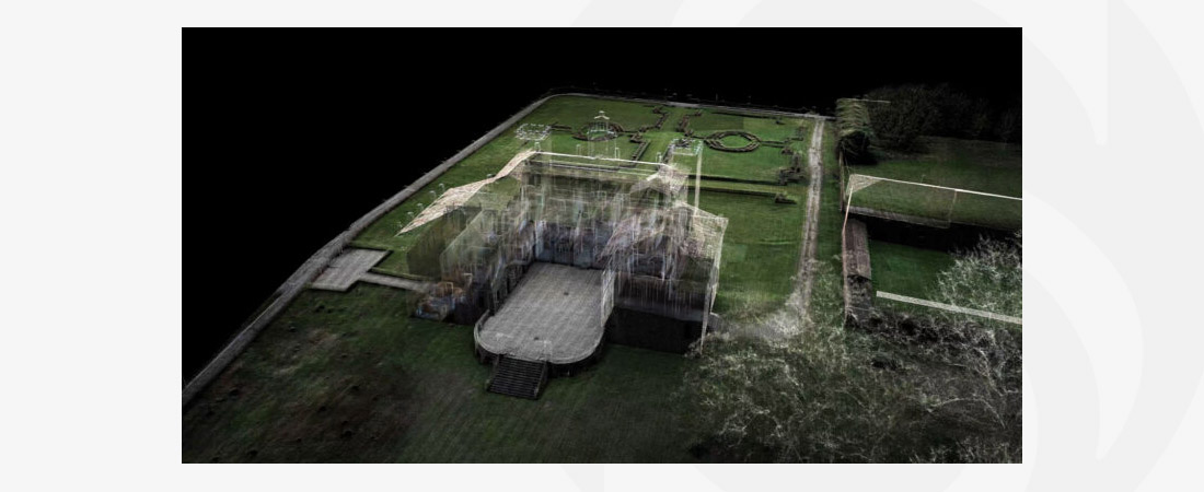
The X200GO is equipped with a 360° rotating laser sensor and two integrated 12 MP cameras. This powerful combination provides a real-time coloured point cloud that can be used immediately. Thanks to the built-in RTK GNSS receiver, you can georeference your data with centimetre accuracy, even while measuring.
X-Whizz Mode: extra detail where it counts
A unique feature of the X200GO is X-Whizz Mode, which allows you to simply stand still for a few seconds in key areas while walking. This results in higher resolution scans without having to switch from mobile to static measurement. This allows you to benefit from speed and detail in one smooth workflow.
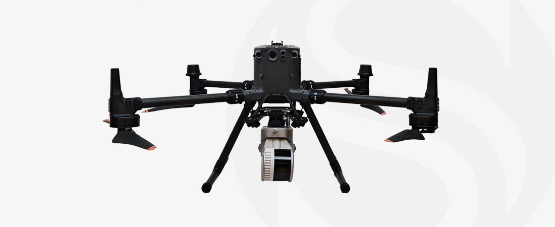
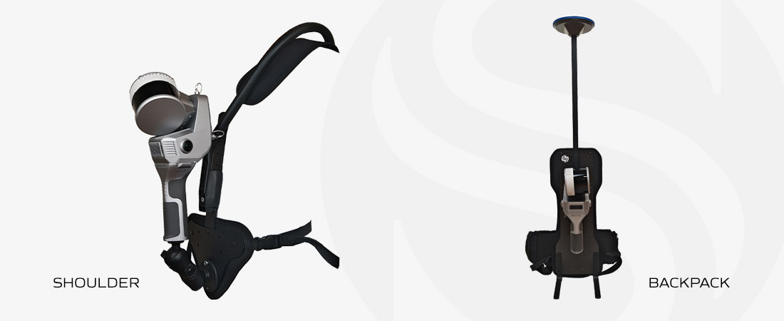
Flexible use, wherever you work
Whether you work on foot, from a vehicle or with a drone, the X200GO adapts to your workflow. You can carry the system as a backpack, mount it on a tripod or vehicle, or use it with a drone such as the DJI Matrice 350.
Applications
- Construction and infrastructure
- Facility management
- Archaeology
- Mining
- Asset inspection
- Tunnel and rail projects
- Digital twin and BIM integrations
Software included
GOapp
The mobile application for project management, real-time point cloud display, firmware updates and image preview. Available for Android and iOS.
GOpost
The Windows software for optimising your dataset, colouring point clouds, generating panoramic images and georeferencing using control points.
Interested or want to request a live demonstration?
Feel free to contact our specialists:
- Timothy Wattimena (Netherlands), call +31 297 769 101
- Hans Rymenants (Belgium and Luxembourg), call +32 14 762 347
Or fill in the contact form using the button below.
CHARACTERISTICS
- Range up to 300 metres
- Data that can be used immediately, without cloud-to-cloud alignment
- Real-time SLAM algorithm, stable even in structurally poor environments
- Automatic recognition of reference points
- Compact and robust design, suitable for any terrain
DOWNLOADS
MORE INFORMATION?
Would you like to know more about our 3D scanners, or make an appointment for a demonstration? Please contact us using the buttons below or call us directly on +31 297 769 101.