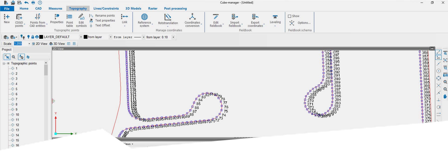
The Stonex Cube-suite CAD software solutions are designed to run on Microsoft Windows desktop computers and provide the tools to download, manage and process data collected with any of our Stonex mobile survey solutions. By using our Cube-suite software you will be able to integrate different types of GNSS RTK and Total Station data, process GNSS raw data in a number of different ways and import and export data in the most commonly used formats.
Our software solutions provide operators with best-in-class data transfer, graphical visualisation and analytical data processing capabilities. The software solutions consist of several optional modules and a free version (Cube-link). You can view survey data in 2D, 3D and overlay it with raster, satellite or cadastral imagery. An advanced in-house CAD solution allows you to interact with the data even in 3D with powerful and comprehensive drawing tools and snap functions. Data import and export is supported in a variety of formats including DXF, DWG, KML, CSV and more.