

Stonex XFLY
Unlock the full potential of aerial surveying with the Stonex XFLY Lidar Series – a cutting edge solution designed for precision, reliability and adaptability. The XFLY Lidar integrates advanced technologies including a high performance Inertial Navigation System (INS), LiDAR and a 24 MP camera to deliver unparalleled point cloud accuracy and detail.
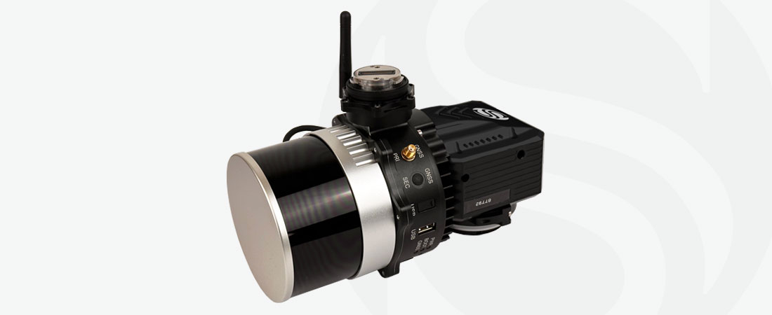
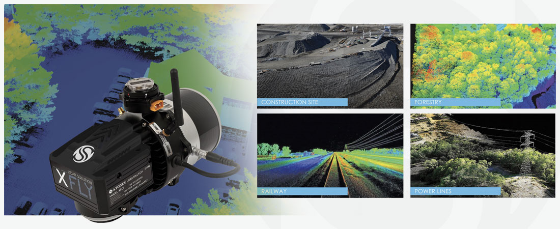
Stonex XFLY Lidar Series
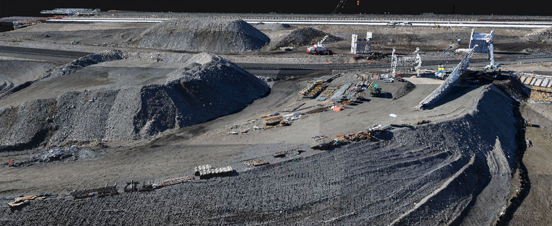
Accurate & reliable point cloud generation
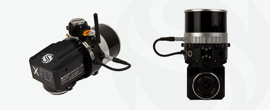
Choose from a range of LiDAR sensors, including the Hesai LiDAR XFLY120, XFLY300 or other options, to meet different customer requirements. The high performance INS ensures clean point cloud generation even at high above ground level (AGL), achieving an impressive 3-5 cm accuracy.
Versatile platform for multiple applications
Equipped with a Wi-Fi interface, embedded cellular modem for RTCM corrections, data logging software and a Gigabit Ethernet network, the XFLY Lidar provides a seamless and efficient solution. Its small, lightweight and low power design allows for longer flight times, adapting to the needs of any project.
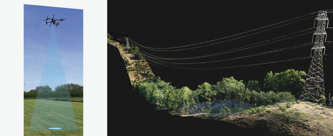
Unmatched AGL capability
Fly with confidence up to 200 metres above ground level, capturing detailed and accurate data for a wide range of applications.
Integrated 24 MP camera for enhanced data
The integrated 24 MP camera adds RGB information to the data, providing additional context to your surveys. The camera comes pre-calibrated with stored boresight values for a hassle-free user experience.
Adaptable mounting for multiple platforms
Choose from a variety of mounts to seamlessly integrate the XFLY Lidar into popular UAVs and other platforms, including DJI M210 – M300 – M350 – M600, Inspired Flight IF1200 Hexacopter, Freefly Alta X, Freefly Astro, WISPR Ranger Pro 1100, and Sony Airpeak S1.
Flexible GNSS Options for Precision
Tailor the XFLY Lidar to your specific application with a choice of single or dual GNSS antennas. For those who prefer real-time data without post-processing, a Real-Time Kinematic (RTK) solution is also available.
Comprehensive post-processing software
Maximise the efficiency of your workflow with the bundled FLYpost software. Correct misalignments between the INS and LiDAR, georeference data to a geographic coordinate system and convert post-processed INS trajectories, LiDAR scan files and camera images to LAS format point clouds for further analysis.
Unlock the full potential of aerial surveying with Stonex XFLY Lidar – where accuracy meets adaptability for unparalleled data collection and analysis.
CHARACTERISTICS
- Accurate & reliable point cloud generation
- Versatile platform for multiple applications
- Unmatched AGL capability
- Integrated 24 MP camera for enhanced data
- Adaptable mounting for multiple platforms
DOWNLOADS
MORE INFORMATION?
Would you like to know more about our 3D scanners, or make an appointment for a demonstration? Contact us via the buttons below or call directly on telephone number +31 297 769 101.