Year-end promotion: 10% discount on RADIODETECTION cable locators and GPR systems
Safe excavation begins with certainty about what lies beneath the surface. Radiodetection is globally renowned
“By deploying the USV, we can collect data safely, comprehensively, and rapidly, allowing us to complete our inspections more efficiently.”
Rijkswaterstaat is responsible for the inspection and maintenance of bridge foundations within the national main waterway network. A key component of this is mapping erosion and sedimentation around bridge piers. These locations are often difficult to access, and gathering reliable underwater data requires a safe and efficient approach.
Traditional inspections relied on divers and manned vessels. This was time-consuming, required extensive planning, and involved safety risks. Furthermore, point measurements provided only a limited overview, often necessitating additional field visits.
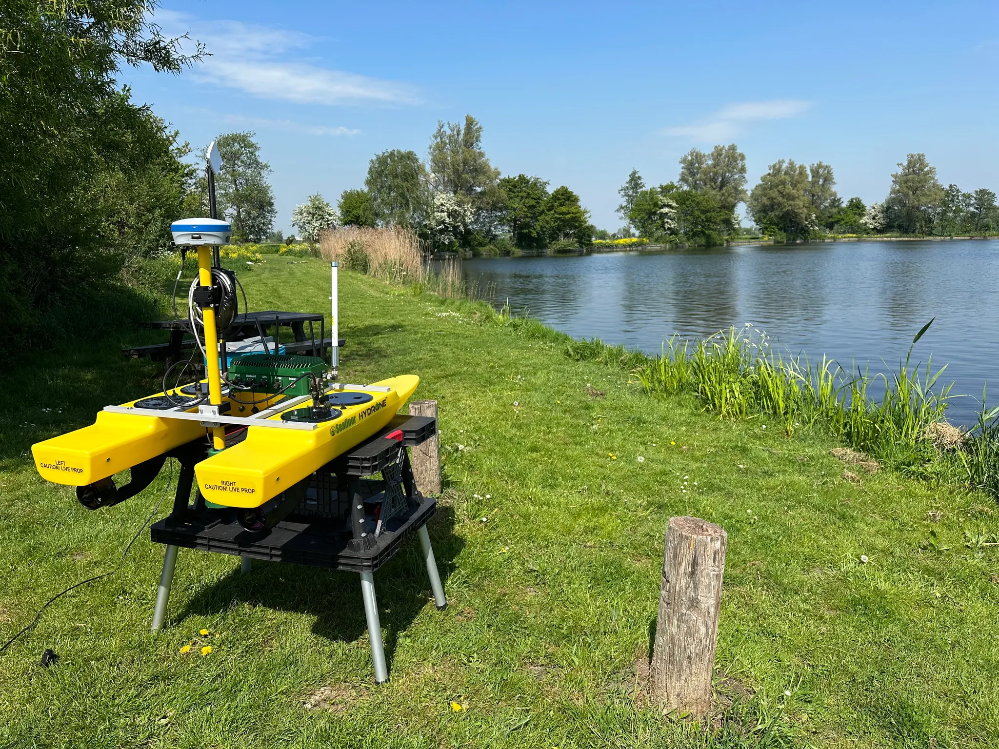
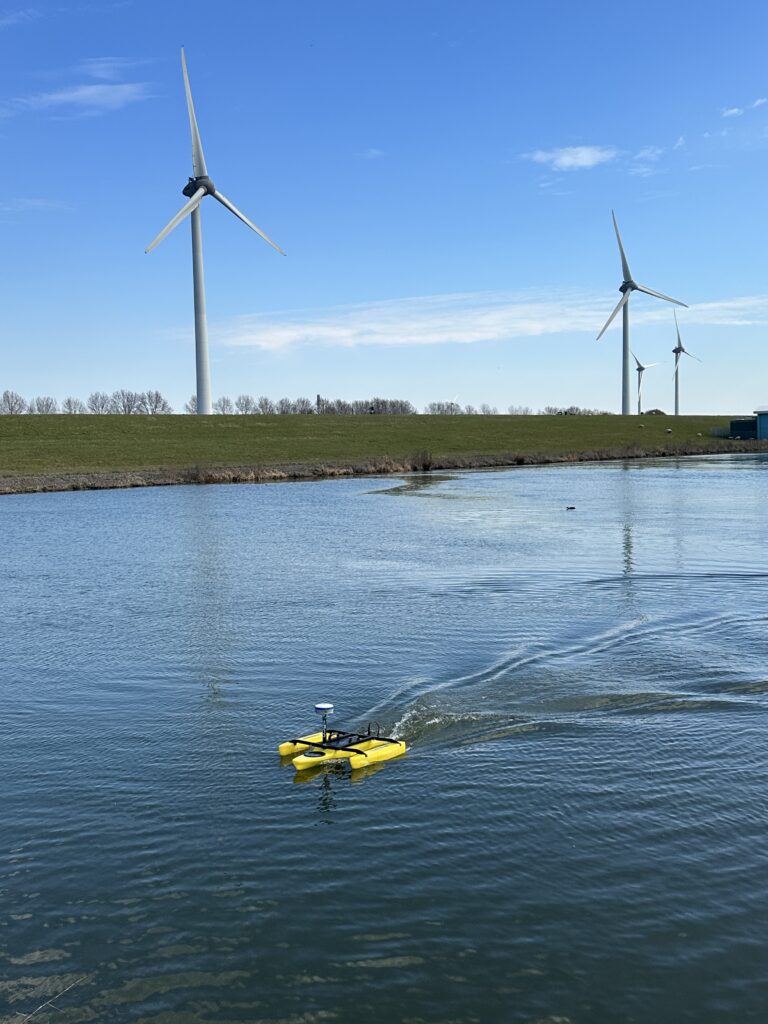
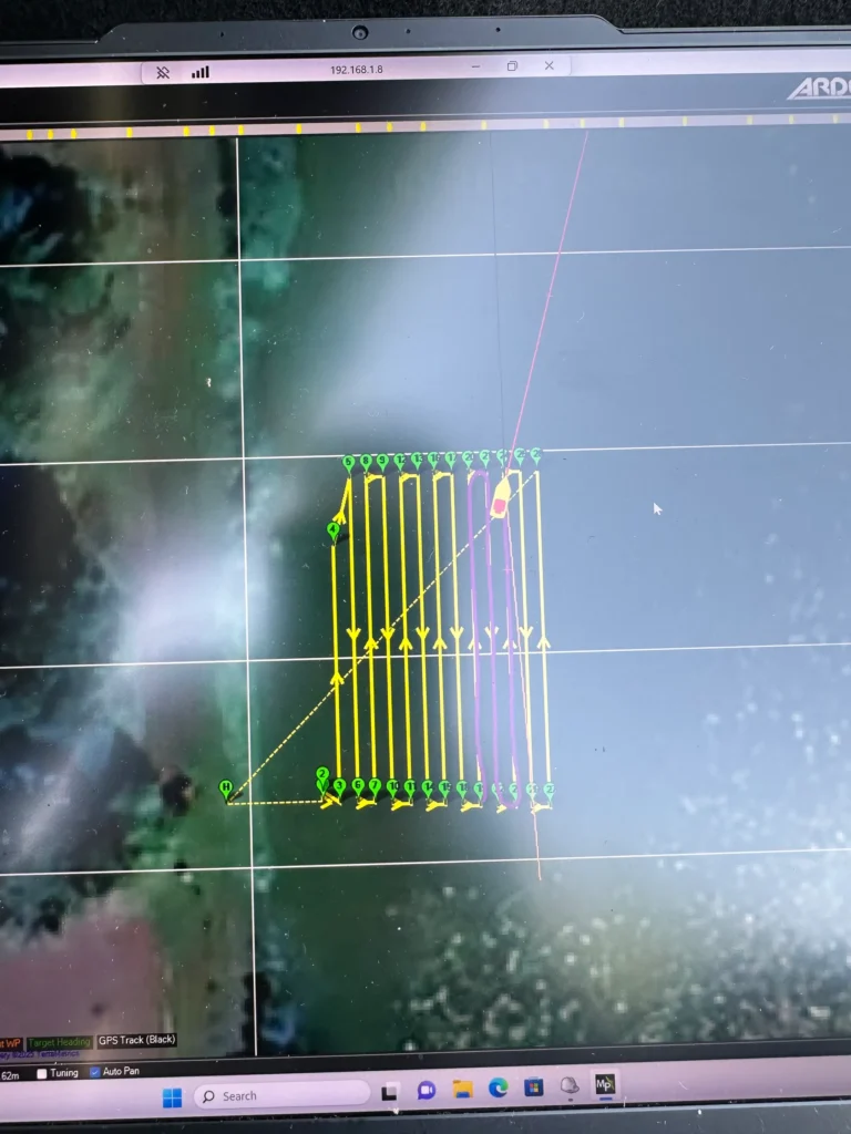
With the USV solution, Rijkswaterstaat was able to bypass these steps. The USV autonomously navigates precise routes under bridges and uses sonar to record a complete bed profile—without the need for manned platforms or diving operations.
“The primary advantage is that we obtain a complete view of the bed in a single pass. If adjustments are needed during the operation, Geodirect can provide immediate remote support. This allows us to continue our work without any delays.”
The USV is easy to operate and can be quickly deployed in areas with limited accessibility. A significant benefit for the team was the ability to perform measurements independently, without relying on external diving crews or inspection vessels.
Data can be verified immediately following the survey session. Any anomalies or risk zones are validated on the spot, typically eliminating the need for a second visit. This saves time and increases planning predictability.
In addition to the physical vessel, Rijkswaterstaat utilizes integrated data processing software. Underwater data is made available to analysts via the cloud in real-time, allowing for seamless integration into existing GIS systems. These integrations accelerate the transition from raw measurements to actionable inspection data, enabling faster report delivery.
The collaboration with Geodirect is seamless. Their team proactively contributes to optimizing safety and data quality. For instance, they recommended using modified survey routes to better capture data in turbulent zones—a minor adjustment that significantly improved measurement reliability.