Stonex Cube-3D training
Process aerial photogrammetry and 3D scan data into accurate models
Home » Stonex Cube-3D training
Stonex Cube-3D training
Process aerial photogrammetry and 3D scan data into accurate models.
The Stonex Cube-3D training has been specifically developed for professionals who want to independently process aerial photogrammetry and 3D scan data into full-fledged, georeferenced 3D models.
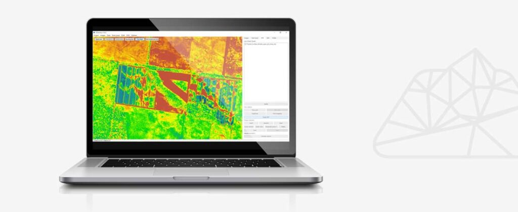
During this training, you will learn how to convert drone imagery and scanner data into point clouds, terrain models, and orthophotos. You will discover how to use Ground Control Points (GCPs) and detail points for maximum precision, and how to apply CAD tools and volume calculations in your workflow.
With Cube-3D, you manage both photogrammetry and scanner data in one integrated software environment. After this training, you will be able to work on advanced 3D projects with confidence and efficiency.
What will you learn?
- Becoming familiar with the Stonex Cube-3D interface: Navigating and working efficiently with the software.
- Importing aerial photos and scan data: Working with various source data and file formats.
- Georeferencing with Ground Control Points (GCPs): Fitting for maximum precision.
- Generating point clouds: Transform images into measurable data.
- Generating digital terrain models: Determine elevations and structures in the environment.
- Generating orthophotos and model visualization: Create accurate 2D representations of the terrain.
- Classification of point clouds: Automated filtering and optimization of data.
- Longitudinal and cross-sections and contour lines: Create and edit sections directly from the point cloud.
- Integrated CAD tools: Working with layers, snapping tools, and drawing options.
- Combining multiple datasets: Manage and integrate photogrammetry, scanner, and traditional survey data.
- Exporting measurement data and generating reports: Share and present your results effortlessly.
- Final assessment and certificate: confirmation of your knowledge and free support after completion.
Applied learning
True expertise comes from doing. In this training, you will work with practical assignments and realistic project cases, so you can apply Cube-3D directly in your work environment.
The training concludes with a final test. Upon successful completion, you will receive a certificate and gain free support from our support department.
Training details
- Duration: 1 day, from 09:00 to 17:00.
- Group size: maximum of 8 participants, ensuring optimal personal guidance.
- Locations: Mijdrecht, the Netherlands; Turnhout, Belgium; or on-site at your location.
- Investment: €550 per person, including teaching materials, certificate, lunch & drinks.
Register easily for the Stonex Cube-a GNSS training via the registration form on this page. Choose a date and location, enter your details, and submit your registration.
Have you already purchased this training with your Stonex RTK GNSS surveying equipment? If so, enter your order number in the comments field. After registering, you will receive an email confirmation with all the details about your participation.
Do you have any questions or would you like personal advice?
Call +31 (0)297 769 101 or contact us via the contact page.
Register for this training?
Fill in the form below and we will contact you regarding available dates.
Looking for a different training?
Bekijk het volledige overzicht op onze trainingspagina.