Year-end promotion: 10% discount on RADIODETECTION cable locators and GPR systems
Safe excavation begins with certainty about what lies beneath the surface. Radiodetection is globally renowned
To better coordinate underground infrastructure works, Synfra was established as a partnership of network operators in Noord-Brabant, Limburg, and Zeeland. Synfra imposes extensive obligations on contractors regarding chain integration and system solutions.
Geodirect links Synfra with GIS and GPS
Synfra stands for ‘synergy in infra’ and is a partnership between Brabant Water, Delta, Endinet, Enexis, Waterleidingmaatschappij Limburg, ReggeFiber, UPC, and Ziggo. The goal is to achieve greater cooperation between network operators and to find combinations in underground infrastructure works. Following a tender in early 2013, Synfra contracted nine new contractors for combined works in various service areas in Noord-Brabant and Limburg, including Hurkmans Groep and Van Vulpen. The Synfra collective imposed the obligation to establish extensive chain integration with clients, including at the system level. This involved a link from Synfra, a link with the contracting sector, and a direct link from the system to personnel out in the field.

Geodirect and Geolantis
Supplier of GPS, CAD & GIS solutions Geodirect has added specific functionalities to the existing Geolantis platform for Synfra contractors to automate connection processes as much as possible and to digitally deliver the revision XML required by Synfra within 24 hours. Geodirect’s Geolantis solution is a GIS platform that creates connections. Van Vulpen entered into this chain optimization in close cooperation with Geodirect. After an intensive six-month project, this resulted in a software solution custom-developed for Van Vulpen. The focus was on the ease of use for both the technician and the work planner. In addition to delivery within 24 hours, it was also ensured that the technician on-site has fewer administrative tasks to perform, allowing them to focus primarily on their work. Revision orders for standard house connections in the Synfra area are sent digitally to Synfra via XML messages. After a brief check, this data is immediately made available to the Land Registry (Kadaster), ensuring the new location is known for future KLIC notifications. Bram Zoeteman, head of the Brabant Infra department at Van Vulpen, believes it is inevitable that house connections will also fall under the Underground Networks Information Exchange Act (WION): “Those are the most common types of damage.”
Accessible open GIS platform
Van Vulpen is responsible for the infrastructure of Brabant Water and Enexis, including house connections. “For example, when we perform a remediation, we survey it. Old pipes are removed and new material is installed,” says Zoeteman. He looks back with satisfaction on the implementation of the new system. Zoeteman calls Geolantis an “accessible open GIS platform. It works on the basis of database objects and data exchange, including XML. The output is shared with the client’s GIS.” The workflow is as follows: “We import data directly from the workflow of Synfra, the client. This concerns all basic data for the house connections. Ultimately, as the contractor, we are responsible for this data.” Once the data is received, Van Vulpen verifies the actual situation with the customer. A work order is then generated, and from that moment, the ‘man in the field’ gets to work.

Quality improvement
Working with Geolantis results in a significant quality improvement. Zoeteman explains: “We now update the total revision data; in the past, this was not nearly as accurate in the contracting industry. Nowadays, the work planner starts their tasks in GIS and prepares the materials. They check the connection values of the geo-objects, the service delivery point, the material, and the connection to the main network, and add all administrative data. They also create an initial digital sketch, testing the measurement values against the drawing specifications.” Zoeteman realizes that this new way of working has consequences for the types of contracts that contractors can secure in 2015. “The contracting industry has shifted in the chain because they are expected to take on coordination and preparation within the house connection process. The new working method will have consequences for a broader range of projects to be delivered. In addition to house connections, the XML process will, for example, also be implemented for main infrastructure projects.”
Out in the field
The question, of course, is how the people in the field view these developments. They work outdoors and have less affinity for administrative processing and digitalization. Zoeteman explains: “This working method is very popular with our technicians. Everything they need is in the van, and they now only perform a final check on the digital drawing. They click on the previously entered measurement and change it if necessary. The technician’s sketch is immediately the final product. The money is truly earned in the field, and they see that themselves. The technicians have therefore been involved in the innovations from the very beginning. They are responsible for the final productivity, and it is important that they specifically see the utility of the changed process and the link with Synfra.” Back at the office, a final check takes place. Once the new situation is ‘Gemma Ready’ (Gemma is Synfra’s web portal), the data is sent to the network operator via XML.
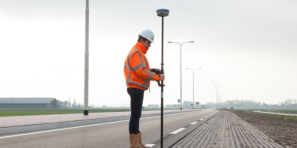
GPS at the core
An elegant feature of Geolantis is that GPS is at the core of all data. Naturally, the base layer is ‘in principle’ the GBKN, BAG, or BGT. But, as Zoeteman explains, “Where we have to work, a base map is often not yet available. We simply turn on the Stonex GPS receiver and survey everything.” Van Vulpen works daily with between thirty and thirty-five GPS receivers. Zoeteman describes the situation: “Everything here is digitally surveyed and drawn. Every team has a Stonex, and everyone at our company performs surveying. This could even be someone who happens to be nearby for another job.” This rapid workflow has a major advantage: the client knows almost immediately where the main pipeline is located. For infrastructure, X, Y, and Z coordinates are surveyed; for house connections, only X and Y are recorded. Van Vulpen sees many opportunities for further development. “Based on our workflow, we can work more progressively. Together with Geodirect, we are now considering new innovations, such as the registration of processed materials.”
Want to know more about this application? Or would you like to book a demo?
Our Sales Engineers are ready to help!
Call +31 297 769 101 or send an email to sales@geodirect.nl and we will be happy to assist you.