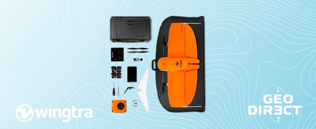
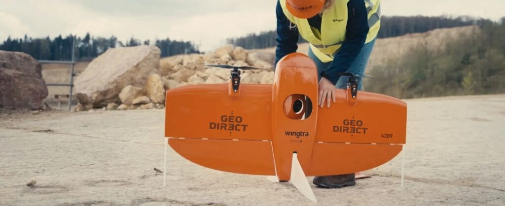
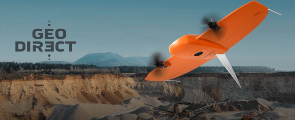
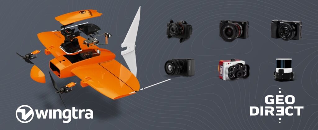
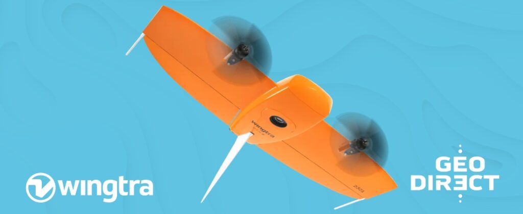
The WingtraOne GEN II provides you with a powerful mapping drone that allows you to complete surveying projects faster, more accurately, and at lower costs. Combining advanced technology, ease of use, and precision, this drone is ideal for large-scale applications such as infrastructure projects, mining, and construction sites. Map large areas in a single flight, with data immediately ready for further analysis. The WingtraOne enables you to complete projects faster, saving you time and money.
Whether it involves scanning, measuring, detecting, or positioning, our wide range of geospatial solutions ensures you will find a suitable solution for every project.
Whether it involves scanning, measuring, detecting, or positioning, our wide range of geospatial solutions ensures you will find a suitable solution for every project.
Whether it involves scanning, measuring, detecting, or positioning, our wide range of geospatial solutions ensures you find a suitable solution for every project.
Whether it involves scanning, measuring, detecting, or positioning, our wide range of geospatial solutions ensures you find a suitable solution for every project.
Whether it involves scanning, measuring, detecting, or positioning, our wide range of geospatial solutions ensures you find a suitable solution for every project.
Whether it involves scanning, measuring, detecting, or positioning, you will find a suitable solution for every project within our wide range of geospatial solutions.
Whether it involves scanning, measuring, detecting, or positioning, our wide range of geospatial solutions ensures you will find a suitable solution for every project.
Whether it involves scanning, measuring, detecting, or positioning, our wide range of geospatial solutions ensures you will find a suitable solution for every project.
At Geodirect, we value high-quality implementation for all our hardware and software solutions. That is why you can also rely on us for training, support, and maintenance.
At Geodirect, we value high-quality implementation for all our hardware and software solutions. That is why you can also rely on us for training, support, and maintenance.
Geodirect B.V. Vermogenweg 107 3641 SR Mijdrecht The Netherlands
Chamber of Commerce number 51485532 VAT number NL850045538B01 IBAN NL43RABO0157787338 BIC RABONL2U
Whether it involves scanning, measuring, detecting, or positioning, you will find a suitable solution for every project with our wide range of geospatial solutions.
Whether it involves scanning, measuring, detecting, or positioning, our wide range of geospatial solutions ensures you find a suitable solution for every project.
Whether it involves scanning, measuring, detecting, or positioning, our wide range of geospatial solutions ensures you find a suitable solution for every project.
Whether it involves scanning, measuring, detecting, or positioning, our wide range of geospatial solutions ensures you find a suitable solution for every project.
Whether it involves scanning, measuring, detecting, or positioning, you will find a suitable solution for every project within our wide range of geospatial solutions.
Whether it involves scanning, measuring, detecting, or positioning, our wide range of geospatial solutions ensures you will find a suitable solution for every project.
Whether it involves scanning, measuring, detecting, or positioning, our wide range of geospatial solutions ensures you will find a suitable solution for every project.
At Geodirect, we value high-quality implementation for all our hardware and software solutions. That is why you can also rely on us for training, support, and maintenance.
At Geodirect, we value high-quality implementation for all our hardware and software solutions. That is why you can also rely on us for training, support, and maintenance.
Geodirect B.V. Vermogenweg 107 3641 SR Mijdrecht The Netherlands
Chamber of Commerce number 51485532 VAT number NL850045538B01 IBAN NL43RABO0157787338 BIC RABONL2U
Whether it involves scanning, measuring, detecting, or positioning, you will find a suitable solution for every project with our wide range of geospatial solutions.