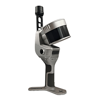
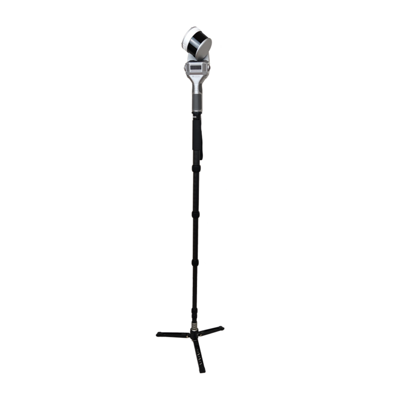
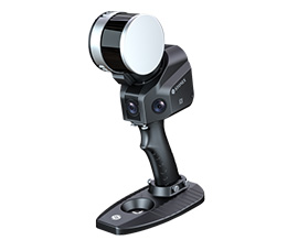
Stonex X120GO for versatile 3D scanning indoors and outdoors
The Stonex X120GO combines a powerful LiDAR sensor, SLAM technology, integrated cameras, and GNSS positioning within a single flexible platform. With a range of up to 120 meters, hybrid scanning capabilities, and various mounting options, the X120GO provides a versatile solution for surveying, infrastructure, inspections, and mobile mapping.
X-Whizz hybrid scanning for overview and detail
With the unique X-Whizz mode, you combine mobile SLAM scans with static scans at key locations. This allows large project areas to be captured quickly while maintaining extra detail at critical measurement points. Both datasets are automatically aligned without manual post-registration.
16- or 32-line LiDAR
Choose the configuration that fits the desired point density and project scope.
Real-time colorized point cloud
Two integrated 12 MP cameras add color information instantly during scanning.
Drone-deployable
Compatible with DJI M350 for combined aerial and ground surveys.
One scanner for buildings, infrastructure, and mobile mapping
The X120GO can be used as a handheld scanner, backpack system, vehicle scanner, or drone payload. This creates a single flexible platform for diverse applications, from building documentation to infrastructure inspections and corridor mapping.
Range up to 120 meters
Suitable for both small spaces and large outdoor projects.
Up to 640,000 points per second
High data density for complex projects.
Automatic control point measurement
Efficient georeferencing without extra measurement rounds.
GNSS and optional RTK
Direct positioning within local or national coordinate systems.
From the air, from the ground, underwater, and in the soil, we help you capture reality. With innovative measurement solutions and expertise that truly makes technology work in practice.
Whether it involves scanning, measuring, detecting, or positioning, you will find a suitable solution for every project with our wide range of geospatial solutions.
Whether it involves scanning, measuring, detecting, or positioning, you will find a suitable solution for every project with our wide range of geospatial solutions.
Whether it involves scanning, measuring, detecting, or positioning, you will find a suitable solution for every project with our wide range of geospatial solutions.
Whether it involves scanning, measuring, detecting, or positioning, you will find a suitable solution for every project with our wide range of geospatial solutions.
Whether it involves scanning, measuring, detecting, or positioning, you will find a suitable solution for every project with our wide range of geospatial solutions.
Whether it involves scanning, measuring, detecting, or positioning, you will find a suitable solution for every project with our wide range of geospatial solutions.
At Geodirect, we value high-quality implementation for all our hardware and software solutions. That is why you can also rely on us for training, support, and maintenance.
At Geodirect, we value high-quality implementation for all our hardware and software solutions. That is why you can also rely on us for training, support, and maintenance.
Geodirect B.V. Vermogenweg 107 3641 SR Mijdrecht The Netherlands
Chamber of Commerce number 51485532 VAT number NL850045538B01 IBAN NL43RABO0157787338 BIC RABONL2U
Whether it involves scanning, measuring, detecting, or positioning, you will find a suitable solution for every project with our wide range of geospatial solutions.
Whether it involves scanning, measuring, detecting, or positioning, you will find a suitable solution for every project with our wide range of geospatial solutions.
Whether it involves scanning, measuring, detecting, or positioning, you will find a suitable solution for every project with our wide range of geospatial solutions.
Whether it involves scanning, measuring, detecting, or positioning, you will find a suitable solution for every project with our wide range of geospatial solutions.
Whether it involves scanning, measuring, detecting, or positioning, you will find a suitable solution for every project with our wide range of geospatial solutions.
Whether it involves scanning, measuring, detecting, or positioning, you will find a suitable solution for every project with our wide range of geospatial solutions.
Whether it involves scanning, measuring, detecting, or positioning, you will find a suitable solution for every project with our wide range of geospatial solutions.
Whether it involves scanning, measuring, detecting, or positioning, you will find a suitable solution for every project with our wide range of geospatial solutions.
Whether it involves scanning, measuring, detecting, or positioning, you will find a suitable solution for every project with our wide range of geospatial solutions.
At Geodirect, we value high-quality implementation for all our hardware and software solutions. That is why you can also rely on us for training, support, and maintenance.
At Geodirect, we value high-quality implementation for all our hardware and software solutions. That is why you can also rely on us for training, support, and maintenance.
Geodirect B.V. Vermogenweg 107 3641 SR Mijdrecht The Netherlands
Chamber of Commerce number 51485532 VAT number NL850045538B01 IBAN NL43RABO0157787338 BIC RABONL2U
Whether it involves scanning, measuring, detecting, or positioning, you will find a suitable solution for every project with our wide range of geospatial solutions.