DJI Matrice 400 – maximum performance for the most demanding drone operations
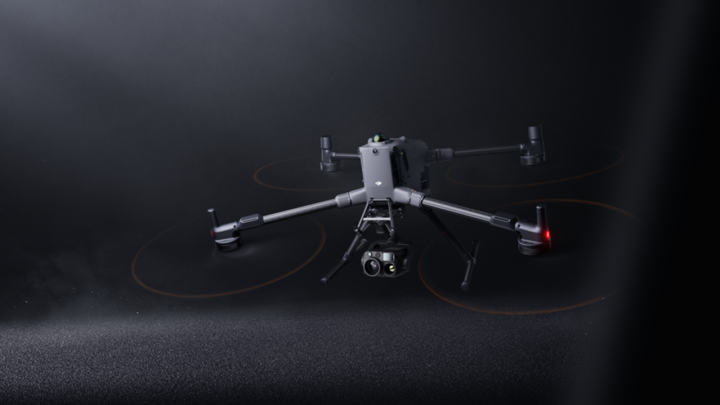
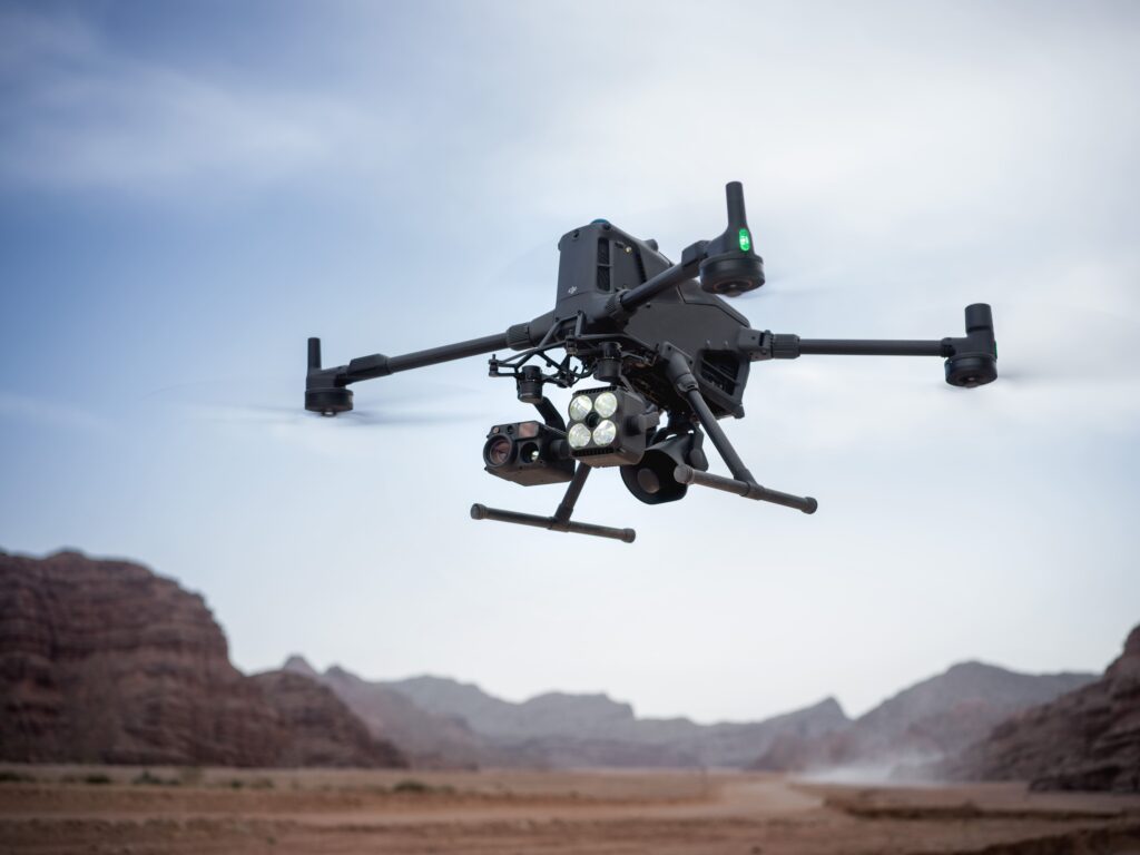
The DJI Matrice 400 is the new flagship within the DJI Enterprise portfolio. With a maximum flight time of 59 minutes, a payload capacity of up to 6 kilograms, integrated LiDAR and radar technology, and support for multiple sensors simultaneously, this platform has been developed for the most complex inspection, mapping, and safety operations.
Advanced obstacle detection for critical infrastructure
The DJI Matrice 400 combines a rotating LiDAR with six mmWave radar sensors for omnidirectional obstacle detection. This allows even thin high-voltage cables to be detected, both during the day and in complete darkness. This makes the platform particularly suitable for inspections of energy infrastructure, power lines, and complex industrial installations.
Up to 59 minutes flight time
Longer missions and larger project areas without intermediate battery swaps.
Payload capacity up to 6 kilograms
Simultaneous deployment of multiple sensors such as LiDAR, thermal cameras, and photogrammetry systems.
Advanced LiDAR and radar detection
Maximum flight safety during inspections of complex infrastructure.
Supports the full DJI Enterprise ecosystem
The Matrice 400 is compatible with the latest DJI Zenmuse sensors for LiDAR, photogrammetry, inspection, and thermography. This allows a single platform to be deployed for diverse applications within energy, infrastructure, public safety, and geospatial projects.
DJI O4 Enterprise Enhanced
Reliable long-range transmission with multiple simultaneous video streams.
RTK positioning
Centimeter-accurate positioning for professional mapping and inspection applications.
IP55 protection
Developed for daily use under challenging weather conditions.
DJI RC Plus 2 Enterprise
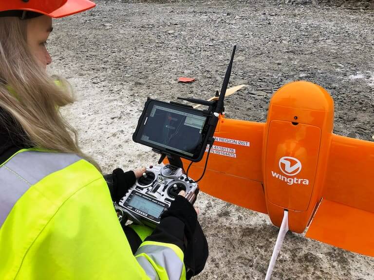
Professional remote control with a large, bright display for outdoor use.
From the air, from the ground, underwater, and in the soil, we help you capture reality. With innovative measurement solutions and expertise that truly makes technology work in practice.
Whether it involves scanning, measuring, detecting, or positioning, you will find a suitable solution for every project with our wide range of geospatial solutions.
Whether it involves scanning, measuring, detecting, or positioning, you will find a suitable solution for every project with our wide range of geospatial solutions.
Whether it involves scanning, measuring, detecting, or positioning, you will find a suitable solution for every project with our wide range of geospatial solutions.
Whether it involves scanning, measuring, detecting, or positioning, you will find a suitable solution for every project with our wide range of geospatial solutions.
Whether it involves scanning, measuring, detecting, or positioning, you will find a suitable solution for every project with our wide range of geospatial solutions.
Whether it involves scanning, measuring, detecting, or positioning, you will find a suitable solution for every project with our wide range of geospatial solutions.
At Geodirect, we value high-quality implementation for all our hardware and software solutions. That is why you can also rely on us for training, support, and maintenance.
At Geodirect, we value high-quality implementation for all our hardware and software solutions. That is why you can also rely on us for training, support, and maintenance.
Geodirect B.V. Vermogenweg 107 3641 SR Mijdrecht The Netherlands
Chamber of Commerce number 51485532 VAT number NL850045538B01 IBAN NL43RABO0157787338 BIC RABONL2U
Whether it involves scanning, measuring, detecting, or positioning, you will find a suitable solution for every project with our wide range of geospatial solutions.
Whether it involves scanning, measuring, detecting, or positioning, you will find a suitable solution for every project with our wide range of geospatial solutions.
Whether it involves scanning, measuring, detecting, or positioning, you will find a suitable solution for every project with our wide range of geospatial solutions.
Whether it involves scanning, measuring, detecting, or positioning, you will find a suitable solution for every project with our wide range of geospatial solutions.
Whether it involves scanning, measuring, detecting, or positioning, you will find a suitable solution for every project with our wide range of geospatial solutions.
Whether it involves scanning, measuring, detecting, or positioning, you will find a suitable solution for every project with our wide range of geospatial solutions.
Whether it involves scanning, measuring, detecting, or positioning, you will find a suitable solution for every project with our wide range of geospatial solutions.
Whether it involves scanning, measuring, detecting, or positioning, you will find a suitable solution for every project with our wide range of geospatial solutions.
Whether it involves scanning, measuring, detecting, or positioning, you will find a suitable solution for every project with our wide range of geospatial solutions.
At Geodirect, we value high-quality implementation for all our hardware and software solutions. That is why you can also rely on us for training, support, and maintenance.
At Geodirect, we value high-quality implementation for all our hardware and software solutions. That is why you can also rely on us for training, support, and maintenance.
Geodirect B.V. Vermogenweg 107 3641 SR Mijdrecht The Netherlands
Chamber of Commerce number 51485532 VAT number NL850045538B01 IBAN NL43RABO0157787338 BIC RABONL2U
Whether it involves scanning, measuring, detecting, or positioning, you will find a suitable solution for every project with our wide range of geospatial solutions.