Mapping underwater assets: from cable routes to pipeline locations
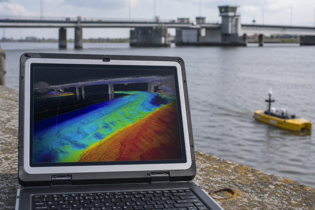
Cables and pipelines crossing waterways, harbors, or coastal areas are vulnerable to anchor and trawl damage, erosion, and subsidence. Accurate bathymetric surveys along cable routes and pipeline corridors are essential for safety, maintenance, and permitting. Whether it involves a pre-lay survey for an underwater crossing, an inspection of an existing pipeline, or post-storm damage verification: bathymetric data forms the foundation of responsible asset management for underwater infrastructure.
What do we deliver?
With our solutions for subsea cables and pipelines, you deliver:
• Longitudinal bathymetry: Profiles along cable routes and pipeline corridors with GPS logging
• Pre/post-lay surveys: Verification of burial depth, erosion, and exposure at landfalls and crossings
• GIS and CAD maps: Seabed topography for risk analysis and grid operator reporting
• Inspection records: Asset management files for periodic repeat measurements and compliance
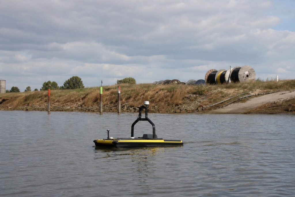
Prior to the installation of a new cable or pipeline, an accurate bathymetric map of the route is essential. TokNav USVs measure the seabed along the entire route, providing input for pipeline design and installation methods.
Post-lay verification and burial depth
After installation, a repeat survey verifies whether the cable is correctly embedded or covered. This is mandatory for most grid operators and forms part of the as-built documentation.
Periodic inspection and risk management
Annual or biennial inspection surveys along existing cable routes provide early insight into exposure, free spans, and erosion, allowing preventive maintenance to be planned before damage occurs.
CASE STUDIES
Voorbeelden uit de praktijk
Zie hoe andere bedrijven uit de Bouw & Infra drones inzetten tijdens hun dagelijkse werkzaamheden.
LiDAR penetrates vegetation to provide a reliable ground level.
Photogrammetry
Open terrain without vegetation
High visual detail quality
Volumetry on visible surfaces
Marketing or presentation footage
Higher image resolution and color, lower sensor investment.
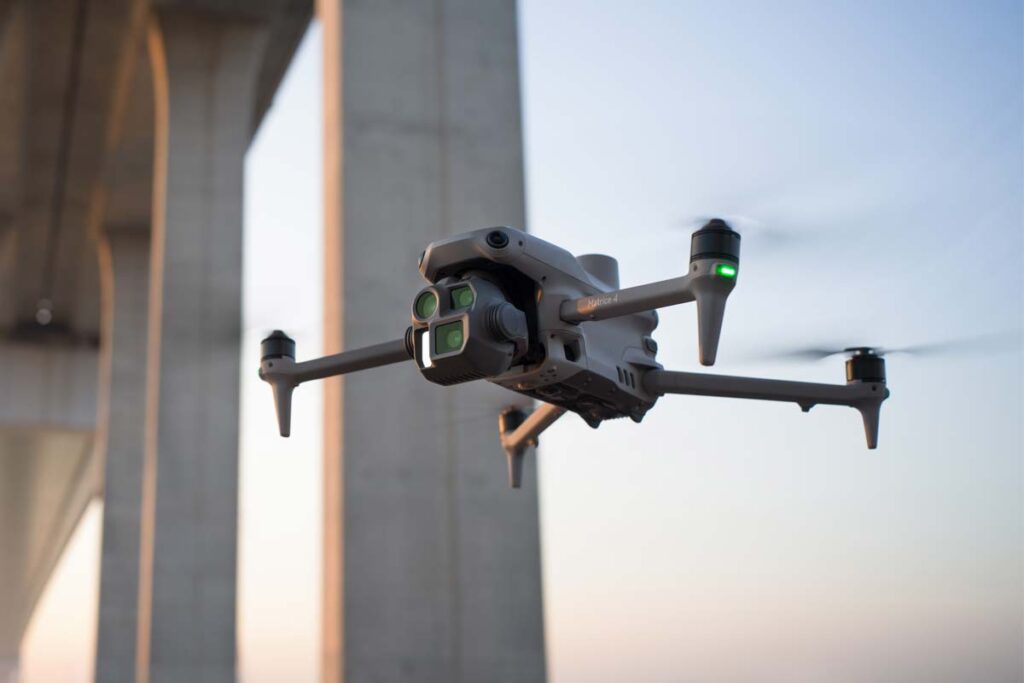
Would you like to know how drone data collection can make your construction and infrastructure projects faster and more accurate?
Timothy will be happy to advise you: from sensor type and flight method (RTK or PPK) to the correct processing workflow and integration with your CAD or GIS environment. Include your specifications or scope, and we will provide immediate advice.
Discover everything about Drone Solutions in our knowledge base.
How accurate are the volume calculations?
With RTK positioning via VRS NEXT, you typically achieve 1-3 cm horizontal ground accuracy. Volume calculations between two measurement moments typically have a deviation of less than 1% with a correct flight plan and sufficient Ground Control Points (GCPs). Timothy will determine the accuracy requirements with you for your specific project.
How does the drone data integrate with our CAD or GIS system?
Final products are delivered in your preferred formats (GeoTIFF, DXF, LAS/LAZ) and in the correct coordinate system (RD/NAP or ETRS89). Direct import into AutoCAD Civil 3D, ArcGIS, QGIS, and most common GIS and CAD environments is standard.
Can I perform periodic progress flights without external support?
Yes. After onboarding, your team will perform flights, processing, and reporting completely independently. Automated mission planning via FlytBase or DJI FlightHub 2 makes repeat flights over the same route reproducible. Geodirect remains available for technical questions.
Is a BVLOS permit required for long corridors?
For BVLOS (Beyond Visual Line of Sight) operations, EASA-compliant certification is required. Geodirect advises and supports you with the permit application and provides drones certified for such operations.
crosslink
crosslink
From the air, from the ground, underwater, and in the soil, we help you capture reality. With innovative measurement solutions and expertise that truly makes technology work in practice.
Whether it involves scanning, measuring, detecting, or positioning, you will find a suitable solution for every project with our wide range of geospatial solutions.
Whether it involves scanning, measuring, detecting, or positioning, you will find a suitable solution for every project with our wide range of geospatial solutions.
Whether it involves scanning, measuring, detecting, or positioning, you will find a suitable solution for every project with our wide range of geospatial solutions.
Whether it involves scanning, measuring, detecting, or positioning, you will find a suitable solution for every project with our wide range of geospatial solutions.
Whether it involves scanning, measuring, detecting, or positioning, you will find a suitable solution for every project with our wide range of geospatial solutions.
Whether it involves scanning, measuring, detecting, or positioning, you will find a suitable solution for every project with our wide range of geospatial solutions.
At Geodirect, we value high-quality implementation for all our hardware and software solutions. That is why you can also rely on us for training, support, and maintenance.
At Geodirect, we value high-quality implementation for all our hardware and software solutions. That is why you can also rely on us for training, support, and maintenance.
Geodirect B.V. Vermogenweg 107 3641 SR Mijdrecht The Netherlands
Chamber of Commerce number 51485532 VAT number NL850045538B01 IBAN NL43RABO0157787338 BIC RABONL2U
Whether it involves scanning, measuring, detecting, or positioning, you will find a suitable solution for every project with our wide range of geospatial solutions.
Whether it involves scanning, measuring, detecting, or positioning, you will find a suitable solution for every project with our wide range of geospatial solutions.
Whether it involves scanning, measuring, detecting, or positioning, you will find a suitable solution for every project with our wide range of geospatial solutions.
Whether it involves scanning, measuring, detecting, or positioning, you will find a suitable solution for every project with our wide range of geospatial solutions.
Whether it involves scanning, measuring, detecting, or positioning, you will find a suitable solution for every project with our wide range of geospatial solutions.
Whether it involves scanning, measuring, detecting, or positioning, you will find a suitable solution for every project with our wide range of geospatial solutions.
Whether it involves scanning, measuring, detecting, or positioning, you will find a suitable solution for every project with our wide range of geospatial solutions.
Whether it involves scanning, measuring, detecting, or positioning, you will find a suitable solution for every project with our wide range of geospatial solutions.
Whether it involves scanning, measuring, detecting, or positioning, you will find a suitable solution for every project with our wide range of geospatial solutions.
At Geodirect, we value high-quality implementation for all our hardware and software solutions. That is why you can also rely on us for training, support, and maintenance.
At Geodirect, we value high-quality implementation for all our hardware and software solutions. That is why you can also rely on us for training, support, and maintenance.
Geodirect B.V. Vermogenweg 107 3641 SR Mijdrecht The Netherlands
Chamber of Commerce number 51485532 VAT number NL850045538B01 IBAN NL43RABO0157787338 BIC RABONL2U
Whether it involves scanning, measuring, detecting, or positioning, you will find a suitable solution for every project with our wide range of geospatial solutions.