DJI Dock 3 – autonomous drone station for inspection, security, and monitoring
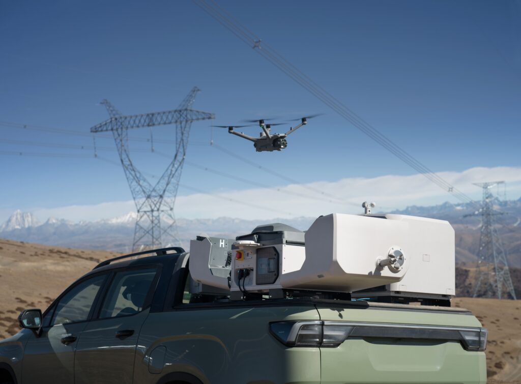
The DJI Dock 3 enables fully autonomous drone operations without the permanent presence of a pilot on-site. In combination with the DJI Matrice 4D or Matrice 4TD, the system automatically executes missions, charges the drone, and protects the equipment from weather influences. For the first time, a DJI Dock also supports vehicle mounting, enabling mobile deployment at varying locations.
The first DJI Dock for mobile and fixed installations
DJI Dock 3 can be permanently installed or deployed mobilely on vehicles. This allows organizations to respond quickly to changing operational needs. The system opens, closes, charges, and manages the drone fully automatically, while integrated climate systems ensure optimal operating conditions in almost all weather conditions.
Fully autonomous drone operations
Automatic flight, landing, charging, and mission management without operator intervention.
Supports vehicle mounting
Flexible deployment at temporary project sites, incident locations, and mobile inspection platforms.
Up to 54 minutes flight time
Long mission duration for extensive inspections, monitoring, and data collection.
Centralized control via DJI FlightHub 2
All missions, live video footage, flight data, and alerts are centrally managed via DJI FlightHub 2. Organizations can manage multiple docks simultaneously, plan automated missions, and realize links with existing corporate and GIS systems via the DJI Cloud API.
Matrice 4D and Matrice 4TD support
Choice between a mapping platform or an inspection and thermal platform.
Integrated weather station sensors
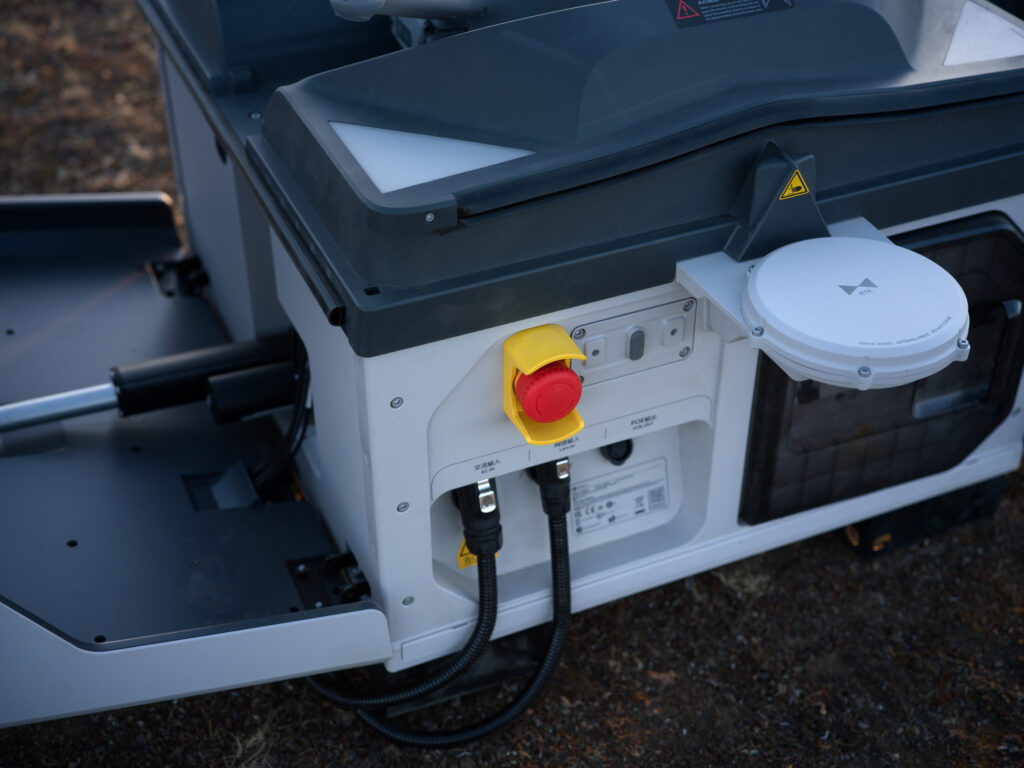
Automatic monitoring of wind, rain, temperature, and humidity.
Backup battery for emergencies
More than four hours of operation during power outages.
IP56-certified dock
Resistant to rain, dust, and challenging outdoor conditions.
From the air, from the ground, underwater, and in the soil, we help you capture reality. With innovative measurement solutions and expertise that truly makes technology work in practice.
Whether it involves scanning, measuring, detecting, or positioning, you will find a suitable solution for every project with our wide range of geospatial solutions.
Whether it involves scanning, measuring, detecting, or positioning, you will find a suitable solution for every project with our wide range of geospatial solutions.
Whether it involves scanning, measuring, detecting, or positioning, you will find a suitable solution for every project with our wide range of geospatial solutions.
Whether it involves scanning, measuring, detecting, or positioning, you will find a suitable solution for every project with our wide range of geospatial solutions.
Whether it involves scanning, measuring, detecting, or positioning, you will find a suitable solution for every project with our wide range of geospatial solutions.
Whether it involves scanning, measuring, detecting, or positioning, you will find a suitable solution for every project with our wide range of geospatial solutions.
At Geodirect, we value high-quality implementation for all our hardware and software solutions. That is why you can also rely on us for training, support, and maintenance.
At Geodirect, we value high-quality implementation for all our hardware and software solutions. That is why you can also rely on us for training, support, and maintenance.
Geodirect B.V. Vermogenweg 107 3641 SR Mijdrecht The Netherlands
Chamber of Commerce number 51485532 VAT number NL850045538B01 IBAN NL43RABO0157787338 BIC RABONL2U
Whether it involves scanning, measuring, detecting, or positioning, you will find a suitable solution for every project with our wide range of geospatial solutions.
Whether it involves scanning, measuring, detecting, or positioning, you will find a suitable solution for every project with our wide range of geospatial solutions.
Whether it involves scanning, measuring, detecting, or positioning, you will find a suitable solution for every project with our wide range of geospatial solutions.
Whether it involves scanning, measuring, detecting, or positioning, you will find a suitable solution for every project with our wide range of geospatial solutions.
Whether it involves scanning, measuring, detecting, or positioning, you will find a suitable solution for every project with our wide range of geospatial solutions.
Whether it involves scanning, measuring, detecting, or positioning, you will find a suitable solution for every project with our wide range of geospatial solutions.
Whether it involves scanning, measuring, detecting, or positioning, you will find a suitable solution for every project with our wide range of geospatial solutions.
Whether it involves scanning, measuring, detecting, or positioning, you will find a suitable solution for every project with our wide range of geospatial solutions.
Whether it involves scanning, measuring, detecting, or positioning, you will find a suitable solution for every project with our wide range of geospatial solutions.
At Geodirect, we value high-quality implementation for all our hardware and software solutions. That is why you can also rely on us for training, support, and maintenance.
At Geodirect, we value high-quality implementation for all our hardware and software solutions. That is why you can also rely on us for training, support, and maintenance.
Geodirect B.V. Vermogenweg 107 3641 SR Mijdrecht The Netherlands
Chamber of Commerce number 51485532 VAT number NL850045538B01 IBAN NL43RABO0157787338 BIC RABONL2U
Whether it involves scanning, measuring, detecting, or positioning, you will find a suitable solution for every project with our wide range of geospatial solutions.