DJI D-RTK 3 Multifunctional Station – one station for RTK corrections, relay functionality, and surveying
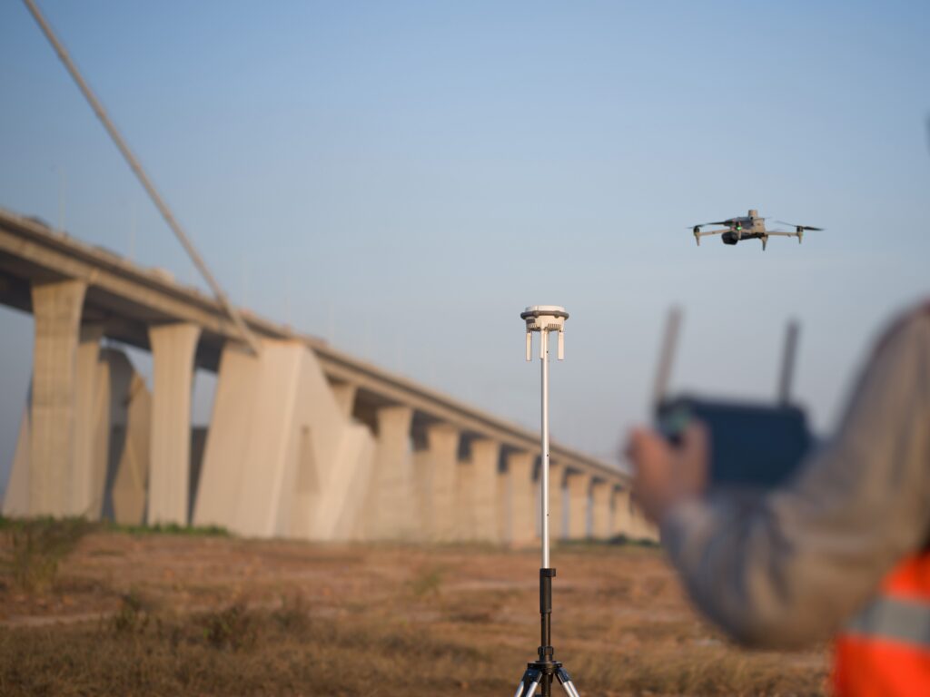
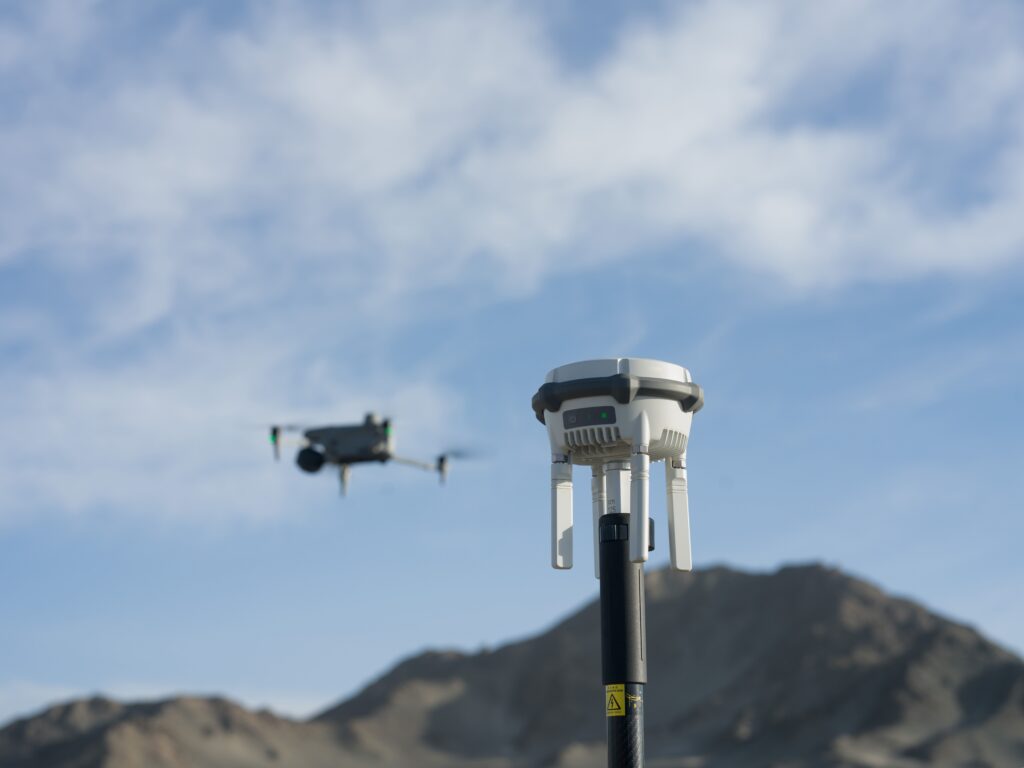
The DJI D-RTK 3 Multifunctional Station is a versatile GNSS reference station that provides RTK corrections to multiple DJI drones simultaneously. The system supports three different operating modes: base station, relay station, and roving station. This makes the D-RTK 3 a central link within professional drone operations, autonomous dock solutions, and surveying workflows.
Three working modes in one powerful platform
The D-RTK 3 can be used as an RTK base station for precise drone flights, as a relay station for greater operational distances, and as a GNSS rover for ground-based measurements. This means only one system is needed for diverse applications in drone mapping, inspection, and surveying.
Supports multiple DJI drones simultaneously
One base station provides RTK corrections to multiple compatible DJI Enterprise platforms.
Base station, relay, and rover in one system
Maximum flexibility for drone operations and ground-based measurements.
Centimeter-accurate RTK positioning
Supports high-quality GNSS corrections for precise mapping and inspection applications.
Extend the range of your drone operations
In relay mode, the D-RTK 3 acts as a communication link between drone and pilot. This allows operations to be carried out in locations where obstacles, buildings, or terrain differences affect communication. This makes the system particularly interesting for complex inspections, large-scale mapping projects, and autonomous DJI Dock installations.
Support for all major GNSS systems
GPS, Galileo, GLONASS, BeiDou, and QZSS for maximum satellite coverage.
IP67 protection
Resistant to dust, rain, and harsh weather conditions.
Up to 10 hours of operating time
Long operational availability without external power supply.
DJI Terra integration
Seamless workflow from flight planning to processing and analysis.
From the air, from the ground, underwater, and in the soil, we help you capture reality. With innovative measurement solutions and expertise that truly makes technology work in practice.
Whether it involves scanning, measuring, detecting, or positioning, you will find a suitable solution for every project with our wide range of geospatial solutions.
Whether it involves scanning, measuring, detecting, or positioning, you will find a suitable solution for every project with our wide range of geospatial solutions.
Whether it involves scanning, measuring, detecting, or positioning, you will find a suitable solution for every project with our wide range of geospatial solutions.
Whether it involves scanning, measuring, detecting, or positioning, you will find a suitable solution for every project with our wide range of geospatial solutions.
Whether it involves scanning, measuring, detecting, or positioning, you will find a suitable solution for every project with our wide range of geospatial solutions.
Whether it involves scanning, measuring, detecting, or positioning, you will find a suitable solution for every project with our wide range of geospatial solutions.
At Geodirect, we value high-quality implementation for all our hardware and software solutions. That is why you can also rely on us for training, support, and maintenance.
At Geodirect, we value high-quality implementation for all our hardware and software solutions. That is why you can also rely on us for training, support, and maintenance.
Geodirect B.V. Vermogenweg 107 3641 SR Mijdrecht The Netherlands
Chamber of Commerce number 51485532 VAT number NL850045538B01 IBAN NL43RABO0157787338 BIC RABONL2U
Whether it involves scanning, measuring, detecting, or positioning, you will find a suitable solution for every project with our wide range of geospatial solutions.
Whether it involves scanning, measuring, detecting, or positioning, you will find a suitable solution for every project with our wide range of geospatial solutions.
Whether it involves scanning, measuring, detecting, or positioning, you will find a suitable solution for every project with our wide range of geospatial solutions.
Whether it involves scanning, measuring, detecting, or positioning, you will find a suitable solution for every project with our wide range of geospatial solutions.
Whether it involves scanning, measuring, detecting, or positioning, you will find a suitable solution for every project with our wide range of geospatial solutions.
Whether it involves scanning, measuring, detecting, or positioning, you will find a suitable solution for every project with our wide range of geospatial solutions.
Whether it involves scanning, measuring, detecting, or positioning, you will find a suitable solution for every project with our wide range of geospatial solutions.
Whether it involves scanning, measuring, detecting, or positioning, you will find a suitable solution for every project with our wide range of geospatial solutions.
Whether it involves scanning, measuring, detecting, or positioning, you will find a suitable solution for every project with our wide range of geospatial solutions.
At Geodirect, we value high-quality implementation for all our hardware and software solutions. That is why you can also rely on us for training, support, and maintenance.
At Geodirect, we value high-quality implementation for all our hardware and software solutions. That is why you can also rely on us for training, support, and maintenance.
Geodirect B.V. Vermogenweg 107 3641 SR Mijdrecht The Netherlands
Chamber of Commerce number 51485532 VAT number NL850045538B01 IBAN NL43RABO0157787338 BIC RABONL2U
Whether it involves scanning, measuring, detecting, or positioning, you will find a suitable solution for every project with our wide range of geospatial solutions.