DJI Mavic 3 Enterprise Series, professional performance in a compact size
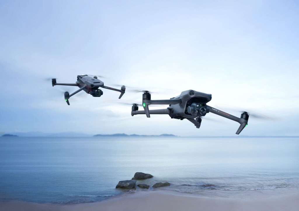
The DJI Mavic 3 Enterprise Series combines the portability of a compact drone with the functionality of a professional Enterprise platform. Available as the DJI Mavic 3E for drone mapping and geospatial applications and the DJI Mavic 3T for thermal inspections and public safety, the series offers a powerful solution for daily professional use.
Developed for rapid deployment and maximum efficiency
Thanks to its compact size, long flight time, and high-quality integrated sensors, the DJI Mavic 3 Enterprise Series can be operational within minutes. This makes the platform ideal for professionals who need to collect high-quality geodata or inspection results quickly and efficiently.
Up to 45 minutes flight time
Efficient coverage of large areas without frequent battery changes.
Compact and portable design
Fits easily into a backpack and is quickly deployable on-site.
RTK support for centimeter-level accuracy
Suitable for professional drone mapping and geospatial applications.
Choose between mapping or thermal inspection
The DJI Mavic 3E is equipped with a high-quality 4/3-inch camera with a mechanical shutter for precise photogrammetry. The DJI Mavic 3T adds a thermal camera for inspection, security, fire detection, and search and rescue operations. This ensures a suitable configuration is available for every application.
Mechanical shutter (Mavic 3E)
Designed for precise photogrammetric capture without rolling shutter effects.
Thermal camera (Mavic 3T)
Detect temperature differences and heat sources, even in darkness.
DJI O3 Enterprise transmission
Stable video link and reliable control over long distances.
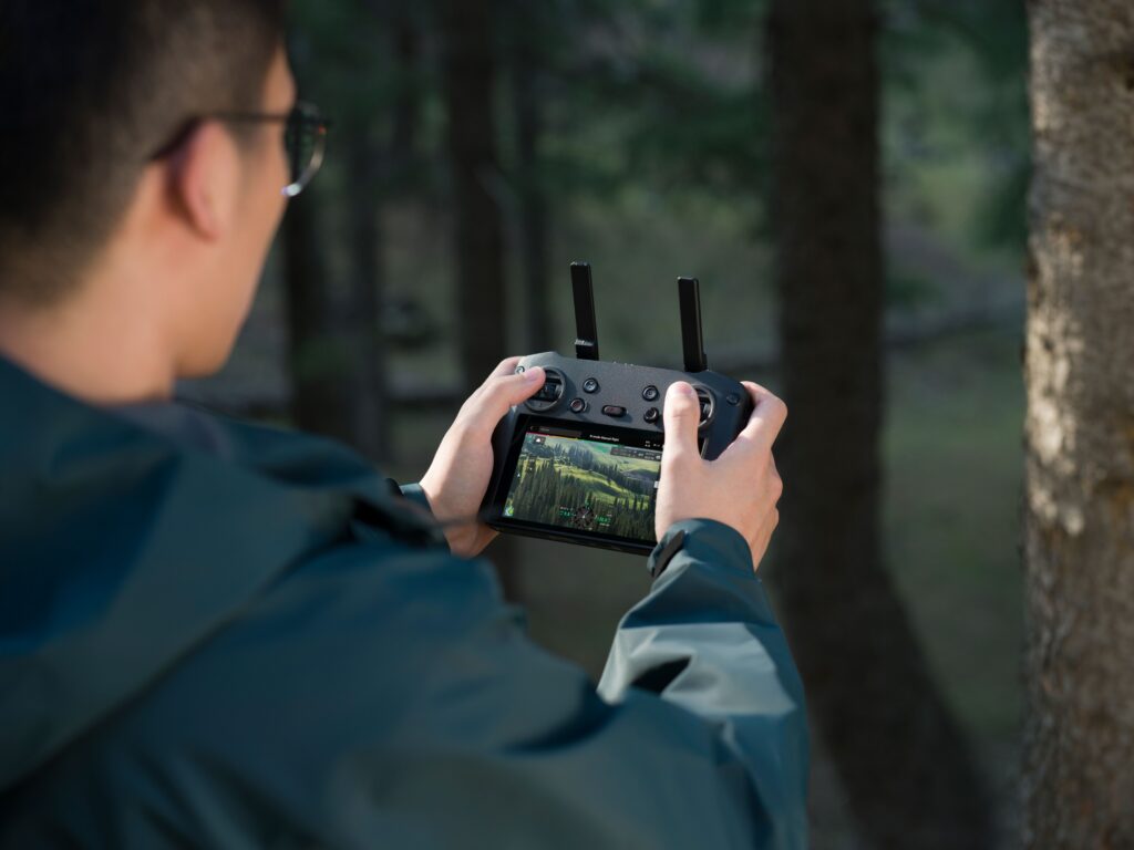
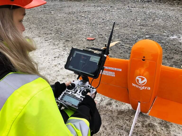
DJI RC Pro Enterprise
Professional remote control with a bright display for use in direct sunlight.
From the air, from the ground, underwater, and in the soil, we help you capture reality. With innovative measurement solutions and expertise that truly makes technology work in practice.
Whether it involves scanning, measuring, detecting, or positioning, you will find a suitable solution for every project with our wide range of geospatial solutions.
Whether it involves scanning, measuring, detecting, or positioning, you will find a suitable solution for every project with our wide range of geospatial solutions.
Whether it involves scanning, measuring, detecting, or positioning, you will find a suitable solution for every project with our wide range of geospatial solutions.
Whether it involves scanning, measuring, detecting, or positioning, you will find a suitable solution for every project with our wide range of geospatial solutions.
Whether it involves scanning, measuring, detecting, or positioning, you will find a suitable solution for every project with our wide range of geospatial solutions.
Whether it involves scanning, measuring, detecting, or positioning, you will find a suitable solution for every project with our wide range of geospatial solutions.
At Geodirect, we value high-quality implementation for all our hardware and software solutions. That is why you can also rely on us for training, support, and maintenance.
At Geodirect, we value high-quality implementation for all our hardware and software solutions. That is why you can also rely on us for training, support, and maintenance.
Geodirect B.V. Vermogenweg 107 3641 SR Mijdrecht The Netherlands
Chamber of Commerce number 51485532 VAT number NL850045538B01 IBAN NL43RABO0157787338 BIC RABONL2U
Whether it involves scanning, measuring, detecting, or positioning, you will find a suitable solution for every project with our wide range of geospatial solutions.
Whether it involves scanning, measuring, detecting, or positioning, you will find a suitable solution for every project with our wide range of geospatial solutions.
Whether it involves scanning, measuring, detecting, or positioning, you will find a suitable solution for every project with our wide range of geospatial solutions.
Whether it involves scanning, measuring, detecting, or positioning, you will find a suitable solution for every project with our wide range of geospatial solutions.
Whether it involves scanning, measuring, detecting, or positioning, you will find a suitable solution for every project with our wide range of geospatial solutions.
Whether it involves scanning, measuring, detecting, or positioning, you will find a suitable solution for every project with our wide range of geospatial solutions.
Whether it involves scanning, measuring, detecting, or positioning, you will find a suitable solution for every project with our wide range of geospatial solutions.
Whether it involves scanning, measuring, detecting, or positioning, you will find a suitable solution for every project with our wide range of geospatial solutions.
Whether it involves scanning, measuring, detecting, or positioning, you will find a suitable solution for every project with our wide range of geospatial solutions.
At Geodirect, we value high-quality implementation for all our hardware and software solutions. That is why you can also rely on us for training, support, and maintenance.
At Geodirect, we value high-quality implementation for all our hardware and software solutions. That is why you can also rely on us for training, support, and maintenance.
Geodirect B.V. Vermogenweg 107 3641 SR Mijdrecht The Netherlands
Chamber of Commerce number 51485532 VAT number NL850045538B01 IBAN NL43RABO0157787338 BIC RABONL2U
Whether it involves scanning, measuring, detecting, or positioning, you will find a suitable solution for every project with our wide range of geospatial solutions.