Emlid Reach RS4 Pro – measuring, staking out, and documenting with GNSS and camera technology
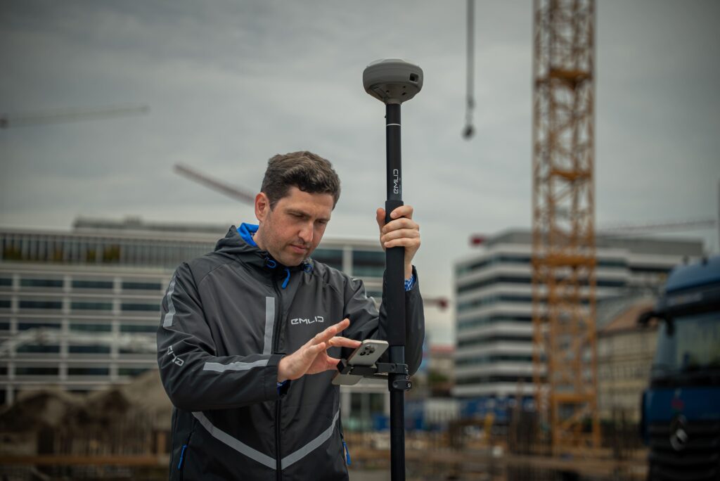
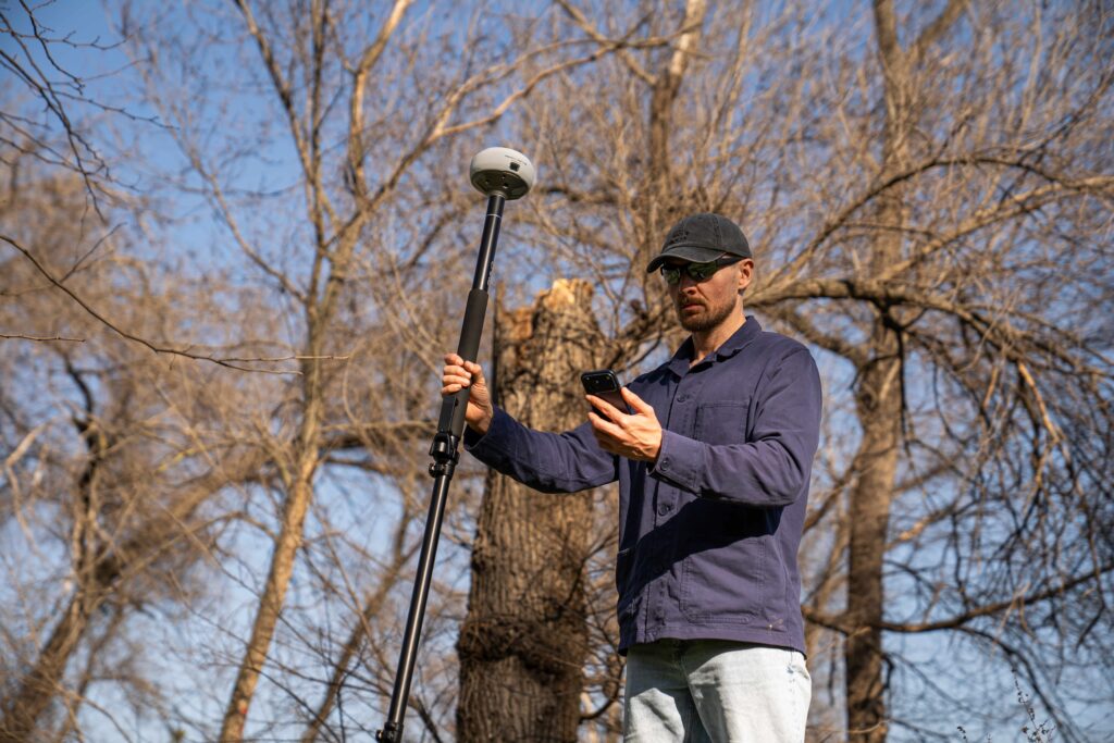
The Emlid Reach RS4 Pro combines professional all-band RTK GNSS technology with two integrated Full HD cameras for augmented reality stakeout and surveying inaccessible points. This allows surveyors, contractors, and GIS professionals to work faster, safer, and more efficiently without relying on additional equipment such as a Robotic Total Station.
Augmented reality stakeout directly on reality
With integrated camera technology, the Reach RS4 Pro projects design data directly onto the live camera feed. This allows the user to see exactly where points, objects, or design data are located in reality. Automatic bullseye navigation and integrated cut & fill functionality make stakeout tasks easier, faster, and more intuitive than traditional methods.
Dual camera for AR stakeout
View design data directly in reality via augmented reality.
Measure unreachable points remotely
Record objects behind fences, over water, or along roads without physical access.
All-band GNSS with 672 channels
Supports L1, L2, L5, and L6 frequencies for maximum reliability and accuracy.
One integrated workflow with Emlid Flow
The Reach RS4 Pro works seamlessly with Emlid Flow for Android and iOS. CAD files, survey data, stakeout points, and project information are directly synchronized with Emlid Flow 360. This ensures field and office staff always have access to the same up-to-date project information.
Dual Full HD camera
Front and bottom cameras for augmented reality and measuring hard-to-reach objects.
Tilt functionality
Measure efficiently without positioning the survey pole perfectly vertical.
LTE, LoRa, and UHF
Maximum flexibility for RTK corrections and communication.
IP68 housing
Resistant to dust, water, and intensive daily use.
From the air, from the ground, underwater, and in the soil, we help you capture reality. With innovative measurement solutions and expertise that truly makes technology work in practice.
Whether it involves scanning, measuring, detecting, or positioning, you will find a suitable solution for every project with our wide range of geospatial solutions.
Whether it involves scanning, measuring, detecting, or positioning, you will find a suitable solution for every project with our wide range of geospatial solutions.
Whether it involves scanning, measuring, detecting, or positioning, you will find a suitable solution for every project with our wide range of geospatial solutions.
Whether it involves scanning, measuring, detecting, or positioning, you will find a suitable solution for every project with our wide range of geospatial solutions.
Whether it involves scanning, measuring, detecting, or positioning, you will find a suitable solution for every project with our wide range of geospatial solutions.
Whether it involves scanning, measuring, detecting, or positioning, you will find a suitable solution for every project with our wide range of geospatial solutions.
At Geodirect, we value high-quality implementation for all our hardware and software solutions. That is why you can also rely on us for training, support, and maintenance.
At Geodirect, we value high-quality implementation for all our hardware and software solutions. That is why you can also rely on us for training, support, and maintenance.
Geodirect B.V. Vermogenweg 107 3641 SR Mijdrecht The Netherlands
Chamber of Commerce number 51485532 VAT number NL850045538B01 IBAN NL43RABO0157787338 BIC RABONL2U
Whether it involves scanning, measuring, detecting, or positioning, you will find a suitable solution for every project with our wide range of geospatial solutions.
Whether it involves scanning, measuring, detecting, or positioning, you will find a suitable solution for every project with our wide range of geospatial solutions.
Whether it involves scanning, measuring, detecting, or positioning, you will find a suitable solution for every project with our wide range of geospatial solutions.
Whether it involves scanning, measuring, detecting, or positioning, you will find a suitable solution for every project with our wide range of geospatial solutions.
Whether it involves scanning, measuring, detecting, or positioning, you will find a suitable solution for every project with our wide range of geospatial solutions.
Whether it involves scanning, measuring, detecting, or positioning, you will find a suitable solution for every project with our wide range of geospatial solutions.
Whether it involves scanning, measuring, detecting, or positioning, you will find a suitable solution for every project with our wide range of geospatial solutions.
Whether it involves scanning, measuring, detecting, or positioning, you will find a suitable solution for every project with our wide range of geospatial solutions.
Whether it involves scanning, measuring, detecting, or positioning, you will find a suitable solution for every project with our wide range of geospatial solutions.
At Geodirect, we value high-quality implementation for all our hardware and software solutions. That is why you can also rely on us for training, support, and maintenance.
At Geodirect, we value high-quality implementation for all our hardware and software solutions. That is why you can also rely on us for training, support, and maintenance.
Geodirect B.V. Vermogenweg 107 3641 SR Mijdrecht The Netherlands
Chamber of Commerce number 51485532 VAT number NL850045538B01 IBAN NL43RABO0157787338 BIC RABONL2U
Whether it involves scanning, measuring, detecting, or positioning, you will find a suitable solution for every project with our wide range of geospatial solutions.