Emlid Reach RX2 – professional GNSS performance in pocket size
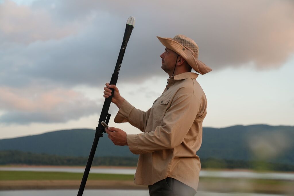
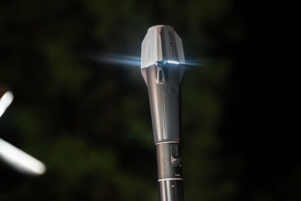
The Emlid Reach RX2 is a compact all-band RTK GNSS rover for surveyors, GIS specialists, contractors, and inspection teams requiring accurate positioning without bulky equipment. Thanks to integrated tilt functionality, support for all modern GNSS constellations, and direct integration with Emlid Flow, the RX2 delivers professional performance in an extremely compact format.
Centimeter accuracy without leveling the pole
The Reach RX2 combines advanced GNSS technology with an integrated IMU for tilt functionality. This allows objects to be measured quickly and accurately without positioning the pole perfectly vertical. This significantly speeds up work at locations with obstacles, slopes, facades, or limited space.
Compact size of only 280 g
Professional GNSS performance in a receiver that easily fits in a pocket.
Tilt functionality without complex calibration
Measure faster in difficult conditions without keeping the survey pole perfectly level.
Direct integration with GIS platforms
Compatible with ArcGIS Field Maps, Survey123, QField, Mergin Maps, and other GIS solutions.
Seamless workflow with Emlid Flow and Flow 360
The Reach RX2 works fully with Emlid Flow for Android and iOS. Measurements, project data, and settings are automatically synchronized with Emlid Flow 360. This ensures field and office staff always have the same up-to-date project information.
All-band GNSS with 672 channels
Support for GPS, GLONASS, Galileo, BeiDou, QZSS, and NavIC on multiple frequencies.
IP68 certified
Waterproof and dustproof for daily use under harsh conditions.
Up to 16 hours of battery life
Measure for a full workday without recharging.
Apple MFi certified
Reliable Bluetooth connection with iPhones and iPads without extra adapters.
From the air, from the ground, underwater, and in the soil, we help you capture reality. With innovative measurement solutions and expertise that truly makes technology work in practice.
Whether it involves scanning, measuring, detecting, or positioning, you will find a suitable solution for every project with our wide range of geospatial solutions.
Whether it involves scanning, measuring, detecting, or positioning, you will find a suitable solution for every project with our wide range of geospatial solutions.
Whether it involves scanning, measuring, detecting, or positioning, you will find a suitable solution for every project with our wide range of geospatial solutions.
Whether it involves scanning, measuring, detecting, or positioning, you will find a suitable solution for every project with our wide range of geospatial solutions.
Whether it involves scanning, measuring, detecting, or positioning, you will find a suitable solution for every project with our wide range of geospatial solutions.
Whether it involves scanning, measuring, detecting, or positioning, you will find a suitable solution for every project with our wide range of geospatial solutions.
At Geodirect, we value high-quality implementation for all our hardware and software solutions. That is why you can also rely on us for training, support, and maintenance.
At Geodirect, we value high-quality implementation for all our hardware and software solutions. That is why you can also rely on us for training, support, and maintenance.
Geodirect B.V. Vermogenweg 107 3641 SR Mijdrecht The Netherlands
Chamber of Commerce number 51485532 VAT number NL850045538B01 IBAN NL43RABO0157787338 BIC RABONL2U
Whether it involves scanning, measuring, detecting, or positioning, you will find a suitable solution for every project with our wide range of geospatial solutions.
Whether it involves scanning, measuring, detecting, or positioning, you will find a suitable solution for every project with our wide range of geospatial solutions.
Whether it involves scanning, measuring, detecting, or positioning, you will find a suitable solution for every project with our wide range of geospatial solutions.
Whether it involves scanning, measuring, detecting, or positioning, you will find a suitable solution for every project with our wide range of geospatial solutions.
Whether it involves scanning, measuring, detecting, or positioning, you will find a suitable solution for every project with our wide range of geospatial solutions.
Whether it involves scanning, measuring, detecting, or positioning, you will find a suitable solution for every project with our wide range of geospatial solutions.
Whether it involves scanning, measuring, detecting, or positioning, you will find a suitable solution for every project with our wide range of geospatial solutions.
Whether it involves scanning, measuring, detecting, or positioning, you will find a suitable solution for every project with our wide range of geospatial solutions.
Whether it involves scanning, measuring, detecting, or positioning, you will find a suitable solution for every project with our wide range of geospatial solutions.
At Geodirect, we value high-quality implementation for all our hardware and software solutions. That is why you can also rely on us for training, support, and maintenance.
At Geodirect, we value high-quality implementation for all our hardware and software solutions. That is why you can also rely on us for training, support, and maintenance.
Geodirect B.V. Vermogenweg 107 3641 SR Mijdrecht The Netherlands
Chamber of Commerce number 51485532 VAT number NL850045538B01 IBAN NL43RABO0157787338 BIC RABONL2U
Whether it involves scanning, measuring, detecting, or positioning, you will find a suitable solution for every project with our wide range of geospatial solutions.