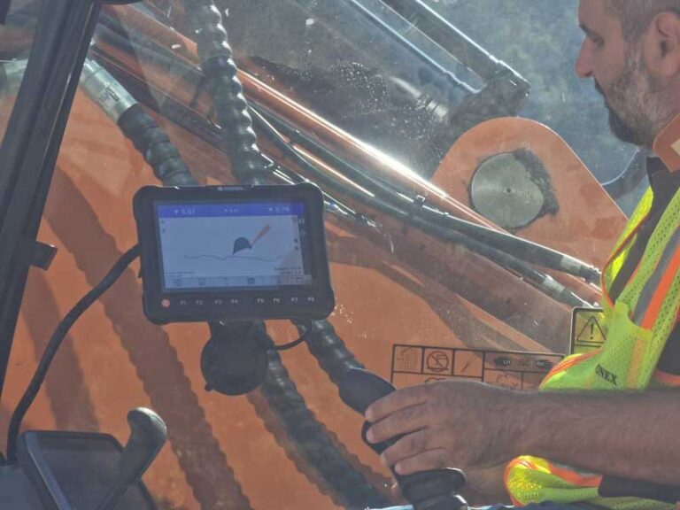
STX-DIG 2D for accurate work on slopes, planes, and complex profiles
STX-DIG 2D builds on the functionality of STX-DIG 1D and adds automatic heading via two GNSS antennas. This allows the system to continuously know which direction the excavator’s superstructure is facing. This enables accurate work on dual slopes, inclines, planes, and complex profile shapes without having to re-orient the machine every time.
Automatic heading via dual GNSS antennas
Two SA45 GNSS antennas continuously determine the superstructure heading and send this data to the Apollo tablet. This ensures the bucket position remains correctly calculated, even when the operator rotates the upper carriage during work. This increases accuracy and enables efficient work on projects with complex geometries.
Work on dual slopes
Easily set longitudinal and cross slopes and work accurately on complex profile shapes.
Tilt bucket support
Optional tilt bucket sensor provides real-time information for accurate control of a tilt bucket.
Ideal for limited GNSS range
Suitable for work under covers, near buildings, and other locations where full GNSS RTK operation is not possible.
More control when digging, profiling, and leveling
STX-DIG 2D offers extra functionality for projects where accurate heading information is essential. Thanks to automatic heading, operators can work more efficiently without constantly creating new references. The system also supports height transfer via a reference point or optional laser sensor and serves as a logical step towards full 3D machine control.
Heading accuracy
Dual GNSS antennas determine the superstructure direction with high precision.
Extensive sensor set
Sensors on frame, boom, arm, and bucket, supplemented with GNSS antennas for heading information.
Work without GNSS RTK
Functions as a powerful 2D solution in environments with limited satellite coverage.
Upgradable
Easy expansion to STX-DIG 3D while retaining existing components.
From the air, from the ground, underwater, and in the soil, we help you capture reality. With innovative measurement solutions and expertise that truly makes technology work in practice.
Whether it involves scanning, measuring, detecting, or positioning, you will find a suitable solution for every project with our wide range of geospatial solutions.
Whether it involves scanning, measuring, detecting, or positioning, you will find a suitable solution for every project with our wide range of geospatial solutions.
Whether it involves scanning, measuring, detecting, or positioning, you will find a suitable solution for every project with our wide range of geospatial solutions.
Whether it involves scanning, measuring, detecting, or positioning, you will find a suitable solution for every project with our wide range of geospatial solutions.
Whether it involves scanning, measuring, detecting, or positioning, you will find a suitable solution for every project with our wide range of geospatial solutions.
Whether it involves scanning, measuring, detecting, or positioning, you will find a suitable solution for every project with our wide range of geospatial solutions.
At Geodirect, we value high-quality implementation for all our hardware and software solutions. That is why you can also rely on us for training, support, and maintenance.
At Geodirect, we value high-quality implementation for all our hardware and software solutions. That is why you can also rely on us for training, support, and maintenance.
Geodirect B.V. Vermogenweg 107 3641 SR Mijdrecht The Netherlands
Chamber of Commerce number 51485532 VAT number NL850045538B01 IBAN NL43RABO0157787338 BIC RABONL2U
Whether it involves scanning, measuring, detecting, or positioning, you will find a suitable solution for every project with our wide range of geospatial solutions.
Whether it involves scanning, measuring, detecting, or positioning, you will find a suitable solution for every project with our wide range of geospatial solutions.
Whether it involves scanning, measuring, detecting, or positioning, you will find a suitable solution for every project with our wide range of geospatial solutions.
Whether it involves scanning, measuring, detecting, or positioning, you will find a suitable solution for every project with our wide range of geospatial solutions.
Whether it involves scanning, measuring, detecting, or positioning, you will find a suitable solution for every project with our wide range of geospatial solutions.
Whether it involves scanning, measuring, detecting, or positioning, you will find a suitable solution for every project with our wide range of geospatial solutions.
Whether it involves scanning, measuring, detecting, or positioning, you will find a suitable solution for every project with our wide range of geospatial solutions.
Whether it involves scanning, measuring, detecting, or positioning, you will find a suitable solution for every project with our wide range of geospatial solutions.
Whether it involves scanning, measuring, detecting, or positioning, you will find a suitable solution for every project with our wide range of geospatial solutions.
At Geodirect, we value high-quality implementation for all our hardware and software solutions. That is why you can also rely on us for training, support, and maintenance.
At Geodirect, we value high-quality implementation for all our hardware and software solutions. That is why you can also rely on us for training, support, and maintenance.
Geodirect B.V. Vermogenweg 107 3641 SR Mijdrecht The Netherlands
Chamber of Commerce number 51485532 VAT number NL850045538B01 IBAN NL43RABO0157787338 BIC RABONL2U
Whether it involves scanning, measuring, detecting, or positioning, you will find a suitable solution for every project with our wide range of geospatial solutions.